Category: Arizona
Road Trip Guide to Lake Havasu City: Home of the London Bridge and a ton of fun!

In this road trip guide to Lake Havasu City, Arizona I will provide route highlights from Phoenix and Las Vegas depending on which direction you are traveling. I also provide a lists of some of the top activities, events and even some of my favorite restaurants. I've also embedded many...
Read moreSedona Road Trip Travel Itinerary

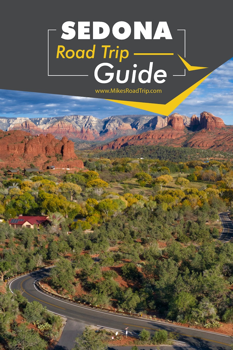
Sedona, Arizona is on the bucket list of road trippers the world over. If you have plans to visit this part of Arizona save time and money with this comprehensive Sedona travel itinerary. Beautifully designed and curated by a Sedona expert and professional travel blogger. Use on your phone, computer...
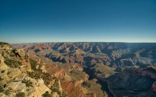
Read moreThings to see in Arizona beyond the Grand Canyon.
There so many things to see in Arizona beyond the mile-deep gorge in the ground known as the Grand Canyon. A whopping 6.3 million people come to Arizona (2017 numbers) to visit the Grand Canyon (up 2 million from just 10 years ago), but other things to see in Arizona...
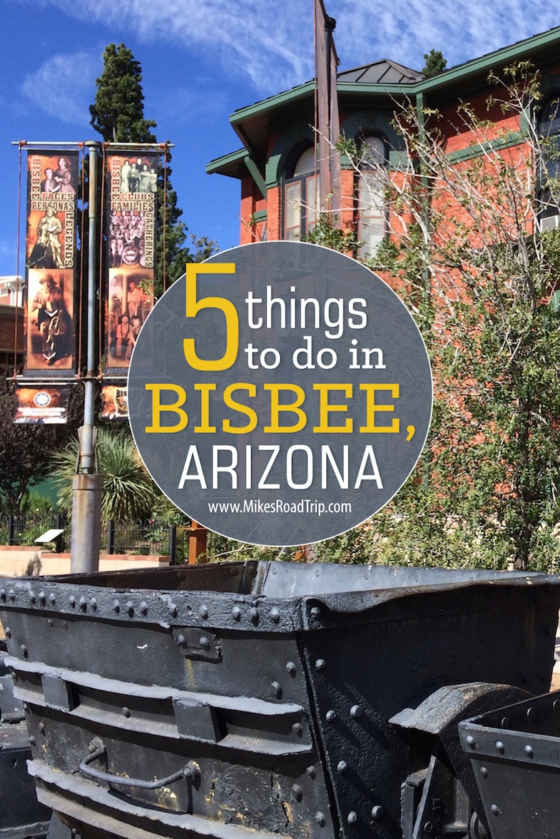
Read moreVisiting Bisbee, Arizona? Here are 5 things to do!

Long ago, Bisbee, Arizona, was the town where copper and silver mines were in full swing. Today, Bisbee celebrates its rich historical heritage while also being a magnet for tourists. This quirky mining town is an enclave for artists with its eccentric charm and picturesque mountainside perch. Located about 90...
Read moreMontezuma Castle – A Truly ‘Historic’ Home
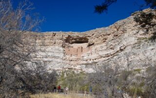
Montezuma Castle is one of Arizona’s many historical treasures—it's a domicile that will captivate you with age old design that has stood the test of time. When one thinks of construction, longevity, or the home-flipping craze…few could withstand the ages of 900+ years. That is an investment unlike any other...
Read moreThe Perfect Five-Day Northern Arizona Road Trip

A Northern Arizona road trip is filled with wonder and amazement as the landscape dazzles road trippers in a sea of divergent and uncommon beauty, with spine-tingling sights along every stretch, and around every bend in the road. There are many National Parks, monuments and man-made wonders to marvel at...
Read moreTop 10 Winter Activities in Flagstaff
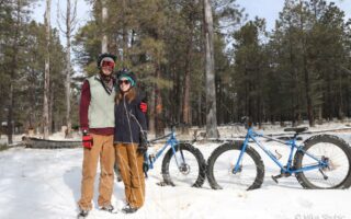
The quintessential American road trip has to be the scenic byways of ol’ Route 66. I have road tripped throughout the state of Arizona, but one place I've not explored in a long time is Flagstaff. I thought it would be fun to head to the highest city along Historic...
Read moreMIM Music Theater is symphonic nirvana

The Arizona Phoenix metro area has an outstanding selection of musical venues in which to enjoy concerts and other live performances. From massive stadiums, arenas, outdoor amphitheater, sophisticated performing art theaters, to intimate venues… Phoenix boasts them all. Opened just a few years ago, one of the newest venues in...
Read moreMcCormick Stillman Railroad Park

Located in the heart of Scottsdale, AZ, the McCormick Stillman Railroad Park is a unique and fun venue for the entire family. You can take a train ride around the 40-acre park, hop on the antique carousel, or visit the newly completed 10,000 square foot model train exhibit. There are...
Read moreTubac and namesake resort captivate visitors
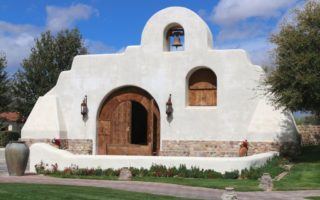
Nestled in the high desert of the Santa Cruz Valley, in the shadow of the Santa Rita Mountains, lies one of the earliest settlements in the state of Arizona. Tubac was established way back in 1752 as a Spanish presidio. However today, artists are more prevalent than a military men....
Read moreTumacacori National Historical Park
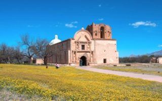
Located just south of Tubac, Arizona in the southern part of the state is a national monument worth a stop....the Tumacacori National Historical Park. This historical park preserves three early Spanish colonial mission ruins. The oldest and best-preserved of the three, San Jose de Tumacacori, was built on the site...
Read moreAntelope Canyon – Nature inspired wonderment
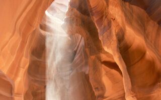
The photos of Antelope Canyon (upper and lower) have inspired the world over. The long and smoothly carved sandstone slot canyon is located on Navajo land in northern Arizona and is one of those places that photos often do justice to the awe-inspire sight. Antelope Canyon is a mecca for...
Read moreLake Havasu Balloon Festival

Everything you need to know about attending the Lake Havasu Balloon Festival. After more than 230 years of flight, hot air balloons still retain their romantic luster...they are both captivating and exhilarating. The sheer size, colors and shapes of hot air balloons can be mesmerizing, especially en mass. I recently...
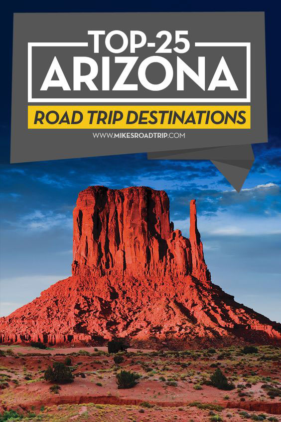
Read moreTop-25 Arizona Road Trip Destinations
Here are 25 Arizona road trip ideas the next time you visit the stunning Southwest. (Updated 6/25/20) An Arizona Road Trip will yield exciting discovers that can only be found in the Southwest. Arizona is a wonderfully diverse state, with an abundance of open space and unforgettable scenery…including one of...
Read more6th annual Zombie Walk in Phoenix

It wasn't just ghosts and goblins this Halloween, it was a massive Zombie Walk at the 6th annual event in Phoenix. Those involved organizing the Phoenix Zombie Walk hoped to break the Guinness World Record for most zombies participating in a zombie walk. Last year’s walk had nearly 20,000 attendees...not...
Read more


![Top-5 Best Places to visit in Belgium beyond Brussels [video included]](https://mikesroadtrip.com/wp-content/uploads/2020/07/Pin-6b.jpg)
![Top-10 Most Interesting Facts about Arizona [Video Included]](https://mikesroadtrip.com/wp-content/uploads/2020/07/Pin-2.jpg)