
Horseshoe Bend: Everything you need to know before you go!
Everything you need to know about visiting Horseshoe Bend
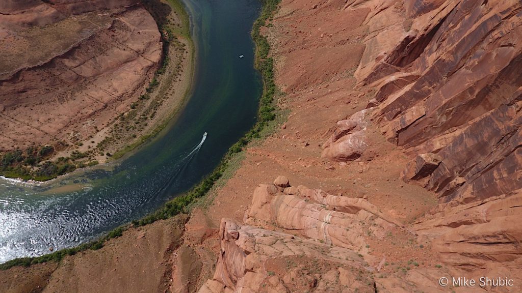
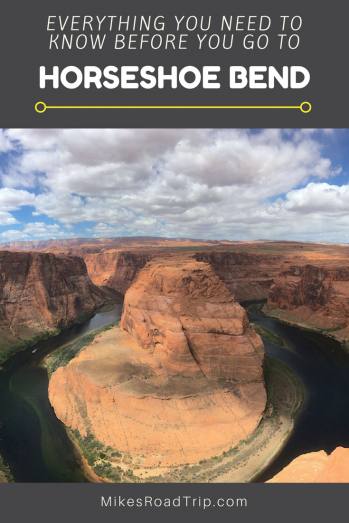
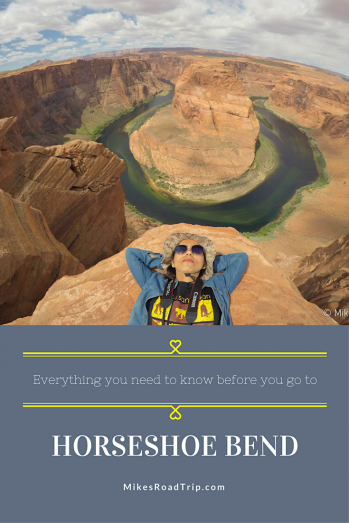
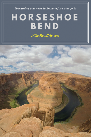
Located just a few mile from the Page Lake Powell area, Horseshoe Bend is one of the most popular roadside attractions in the state of Arizona. Calling Horseshoe Bend a “roadside attraction” may not be completely accurate as it does require a bit of a hike to see the iconic southwestern sight, but it is located right off of scenic Highway 89.

There is large parking lot with public restrooms available. Once you park your car and gather your provisions, such as water, sunscreen, camera, bandanna and snacks, you can start to ascend the hill that takes you to a plateau. As you continue toward the overlook, there is an awning area to sit and rest while getting some shade before heading down a slight decline for the other half of the hike. It’s not really a difficult hike, but more of a hilly walk, which is 1.5 miles round trip. The last time I was there, work on the trail was being conducted, so visitors were being diverted into a sandy area that took some effort to trudge through. During the cooler months of the year the walk is fairly leisurely, however in the summer with sun blazing, the trek can feel much longer, especially toward the car after leaving the cliffs of Horseshoe Bend.
Horseshoe Bend Stats and Information:
- The overlook is 4,200 feet above sea level, the Colorado River is at 3,200 feet, making it a 1,000-foot drop.
- Open 24 hours a day.
- Best times to visit Horseshoe Bend is mid-morning, say 9-10am depending on the time of year. You want the sun to shine on the sight, so waiting a few hours after sunrise is best. Sunset is also a great time to visit. Try and avoid visiting during the middle of the day as you will encounter hoards of people as many tour buses stop by throughout the day.
- The sandstone piece of land in the middle of Horseshoe bend looks like an island, but it’s actually connected to the earth on the other side.
- There is no permit or entrance fee. Free to visit.
- The water flowing around Horseshoe Bend is the Colorado River, which is dammed up by Glen Canyon Dam that holds back the water to form Lake Powell, the second largest man-made lake in the United States.
- The surrounding area borders the Navajo Nation, which is home to more than 7,000 residents. Another popular attraction in the area is Antelope Canyon.
- Address: Glen Canyon National Recreation Area, Hwy 89 S, Page, AZ 86040
If you’ve ever been to Horseshoe Bend in Northern Arizona, please leave a comment below and share your experience.

Mike Shubic
Comments are closed.


![Top-5 Best Places to visit in Belgium beyond Brussels [video included]](https://mikesroadtrip.com/wp-content/uploads/2020/07/Pin-6b.jpg)
![Top-10 Most Interesting Facts about Arizona [Video Included]](https://mikesroadtrip.com/wp-content/uploads/2020/07/Pin-2.jpg)


4 Comments
Thank you for all of this information you wrote. It helped me a lot. I’m a 6th grader and my family is planning on going to Canyons and I think it will be a great trip because of your help.
I’m so glad you found it helpful. Thanks for stopping by. Hope you enjoy. Cheers, Mike
Great location to visit in usa